A farming system is defined as a population of individual farm systems that may have widely differing resource bases, enterprise patterns, household livelihoods and constraints. With the ECI lens, farm mapping allows farmers to create detailed maps of their agricultural land. The maps usually contain land boundaries, locations of buildings, fences, gateways, and water pipes located on a farm. A farming systems map will identify areas where manure-contaminated runoff water from the livestock operation, barnyard, or manure storage comes into contact with clean water. The map may also reveal if manure is spread too close to a stream or wetland. For farmer to take consideration of various facets of landforms like altitude, relief, slope, the direction of slope, and the drainage. For this, contour maps help the farmers to understand the above characteristics of the landforms. These maps prove to be of great use in the planning for a region too. Soil mapping involves locating and identifying the different soils that occur, collecting information about their location, nature, properties and potential use, and recording this information on maps and in supporting documents to show the spatial distribution of every soil. Farming systems mapping through GIS can substantially help in effective crop yield estimates, soil amendment analyses, erosion identification and remediation. More accurate and reliable crop estimates help reduce uncertainty.
Blog
-
Farming Systems Mapping for Sustainable Mountain Agriculture
]]>
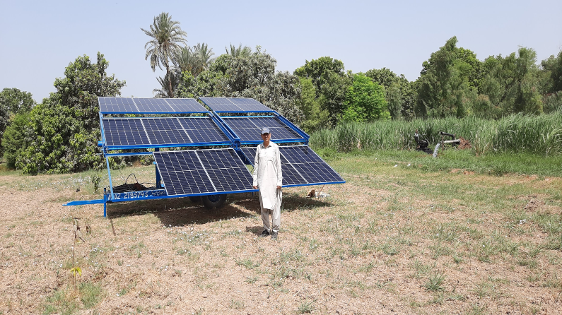
Facilitating our stakeholders for #JustEnergyTransition to happen
Farming communities in Pakistan are fast transitioning to #CleanEnergy after skyrocketing price hike of oil-based electricity bills. To begin with, solar-based water pumps are being widely used amidst heatwave scenario in south Asia and decreasing freshwater resources. However, as noticed recently, ground water table has started to lower sharply in many areas, particularly in south Punjab and Balochistan provinces of Pakistan due to sudden increase of solar water pumps to extract ground water. Eco-Conservation Initiatives (ECI) is helping farmers adopt a range of water recharge approaches to address this challenge. In addition to this, the organization had already tested a pilot project in northern Punjab (salt range area) with sponsorship by Pakistan Water Partnership (PWP) building nexus of energy-water-food through the use of biomass energy. Being influenced by the Just Energy Transition Framework developed by the Council for Inclusive Capitalism @InclusiveCap, ECI has started to raise awareness in some target areas to promote #JustEnergyTransition where social and environmental risks related to labor force, tourism, one-health, cost of energy supply, air & water pollution and solid waste disposal will have to be seriously taken into account.